Highlights
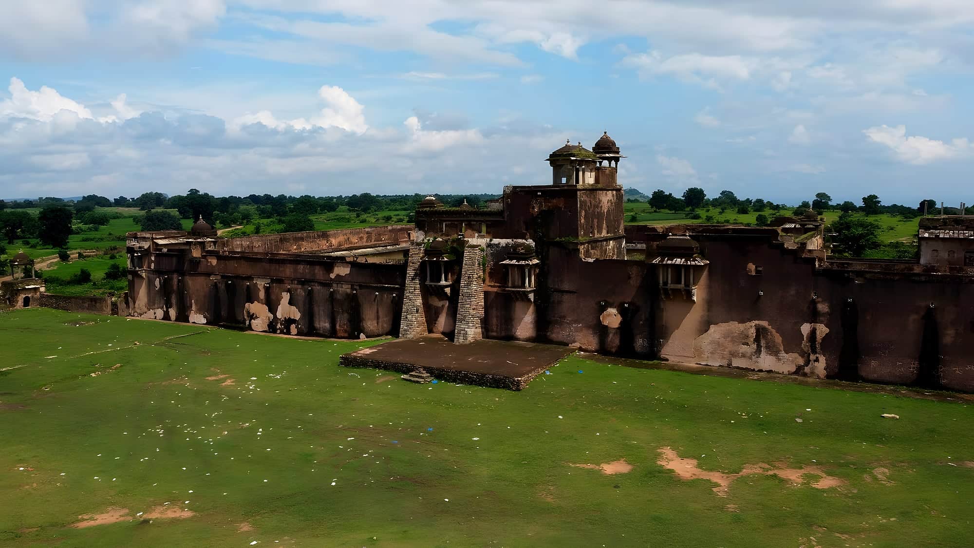
- Aina Mahal & Takht-e-Padshahi — Man Singh's palace and his hall of audience; climb for the Son valley view..
- Hathiya Pol — The elephant gate with its carved elephants, the fort's grandest entrance..
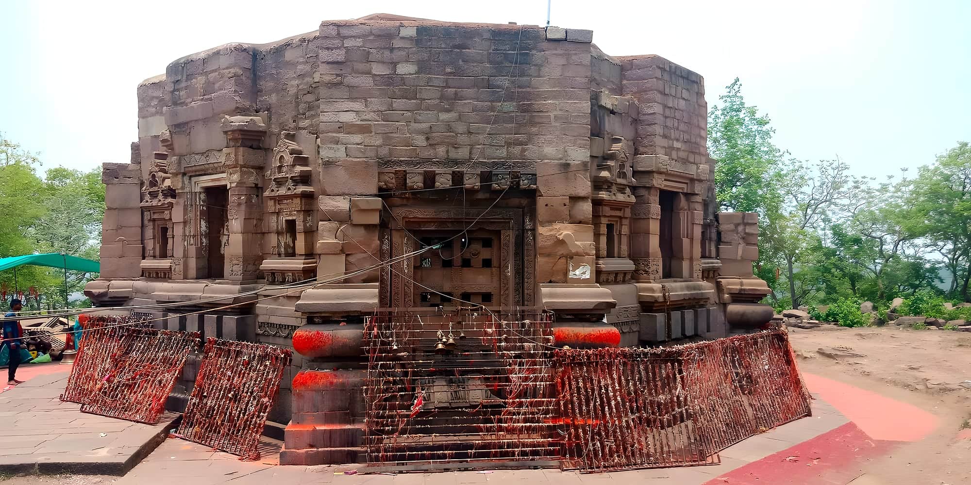
- Rohitashva temple — On the summit; the view at sunset runs to the Son and the Kaimur escarpment..
- Jama Masjid — Three-domed Mughal mosque in the garrison town..
Legend credits the fort to Rohitashva, son of the truthful king Harishchandra; history credits the Kharwar and Chero chiefs of these hills, then Sher Shah Suri, who took it by trickery in 1539, and then Akbar's general Man Singh, who governed Bihar and Bengal from here and built the palace complex that survives.
What makes Rohtasgarh unusual is scale. The plateau is 28 square miles; the perimeter wall is 45 km with 83 gates, and inside are Man Singh's three-storeyed Aina Mahal and Takht-e-Padshahi, the Hathiya Pol elephant gate, the Jama Masjid, the Ganesh temple and the Rohitashva temple at the highest point. Villages still farm the plateau; langurs own the ruins.
The approach is half the experience. From Akbarpur at the foot you either walk up the medieval stepped path through the forest — about two hours — or drive a steep, unmade jeep track. Either way the moment you come through the Kathautiya gate on to the plateau is unforgettable.
Chapter 01
How it came to be
The plateau fort is older than any record — local legend credits Rohitashva, son of the truthful king Harishchandra. What is certain is that Hindu rajas held it for centuries until Sher Shah took it in 1539 by a famous ruse: he asked the Raja to shelter his women and sent soldiers in the covered palanquins. After Akbar's conquest it became the headquarters of Raja Man Singh of Amber as governor of Bihar and Bengal, and most of the palaces you see are his — a Rajput court on a Bihar mountain.
The fort passed through Mughal and Nawabi hands, was briefly a British post after Buxar, and then was simply left. For most of the twentieth century it was inaccessible, the plateau home to Oraon and Kharwar villages and, until 2015 or so, to Maoist camps. It is open and safe now, and almost entirely empty.
Chapter 02
What it's like now
You climb for an hour by jeep up a rough road onto a tabletop of grass and forest, and then drive across it for kilometres before the first wall appears. Rohtasgarh is a fortified landscape rather than a fort: villages, fields and ponds inside the ramparts, and at its heart the ruins of Man Singh's palace — a four-storey Rajput mahal with painted ceilings and the Takht-e-Padshahi, a viewing pavilion on the cliff edge with a view 500 metres straight down to the Son.
Walk to the Ganesh temple, the Hathiya Pol elephant gate, the Jami Masjid and the Aina Mahal; then to the Rohtasan temple on the highest point, where the plateau falls away on all sides. You will share it with cattle, langurs and perhaps a shepherd. Carry everything you need, start at dawn, and give it the whole day.
Chapter 03
What to see
- 01
Aina Mahal & Takht-e-Padshahi
Man Singh's palace and his hall of audience; climb for the Son valley view.
- 02
Hathiya Pol
The elephant gate with its carved elephants, the fort's grandest entrance.
- 03
Rohitashva temple
On the summit; the view at sunset runs to the Son and the Kaimur escarpment.
- 04
Jama Masjid
Three-domed Mughal mosque in the garrison town.
- 05
The stepped path
Medieval stone stairs through sal forest from Akbarpur.
Chapter 04
A perfect day
6:00
Leave Sasaram or Dehri with a hired jeep and driver who knows the road.
8:00
Begin the ascent from Akbarpur; on top by 9.
9:30
Man Singh's palace — the mahal, the painted rooms, the Takht-e-Padshahi balcony.
11:30
Hathiya Pol, Jami Masjid, Aina Mahal, Habsh Khan's tomb.
13:00
Picnic lunch; the Rohtasan temple and the cliff edge.
15:00
Descend; Dhua Kund on the way back if it's monsoon.
Chapter 05
Stay, eat, celebrate
Where to stay
No accommodation on the plateau. Base in Sasaram or Dehri-on-Sone; Forest Department rest house at Rohtas village by advance request.
Where to eat
Nothing on top — carry food and at least 3 litres of water per person. Dhabas at Akbarpur at the foot.
Practical
Getting there
Fly
Varanasi (VNS) 160 km; Patna (PAT) 200 km.
Train
Sasaram Junction 40 km; Dehri-on-Sone 35 km.
Road
Akbarpur village at the foot is 40 km from Sasaram. Jeep to the top from Akbarpur or Rohtas town; ask locally.
On the map · Rohtasgarh Fort is at 24.6208°N, 83.9192°E in Rohtas district, about 214 km (5 h) by road from Patna.
Before you go · Best time to visit · Safety, dress code & money · What to eat nearby
Practical
Distances from Rohtasgarh Fort
Road distance and realistic driving time on Bihar roads — plan around these, not the straight line on a map.
From the gateway cities
| Gaya → Rohtasgarh Fort | 144 km | 3½ h |
| Patna → Rohtasgarh Fort | 214 km | 5 h |
| Muzaffarpur → Rohtasgarh Fort | 288 km | 7 h |
| Darbhanga → Rohtasgarh Fort | 340 km | 8½ h |
| Bhagalpur → Rohtasgarh Fort | 412 km | 10 h |
To nearby places
| Rohtasgarh Fort → Tutla Bhawani | 31 km | 0½ h |
| Rohtasgarh Fort → Dhua Kund & Manjhar Kund | 33 km | 0½ h |
| Rohtasgarh Fort → Sasaram | 49 km | 1 h |
| Rohtasgarh Fort → Shergarh Fort | 53 km | 1 h |
| Rohtasgarh Fort → Telhar Kund & Karkatgarh | 60 km | 1½ h |
| Rohtasgarh Fort → Deo Sun Temple | 68 km | 1½ h |
| Rohtasgarh Fort → Mundeshwari Temple | 76 km | 1½ h |
| Rohtasgarh Fort → Bakhtiyar Khan's Tomb, Chainpur | 80 km | 2 h |
| Rohtasgarh Fort → Buxar | 137 km | 3 h |
| Rohtasgarh Fort → Jagdishpur & Arrah | 139 km | 3 h |
| Rohtasgarh Fort → Bodh Gaya | 141 km | 3½ h |
| Rohtasgarh Fort → Gaya | 144 km | 3½ h |
Estimates: road ≈ 1.3 × straight-line, ~40 km/h average. All Bihar distances →