Highlights
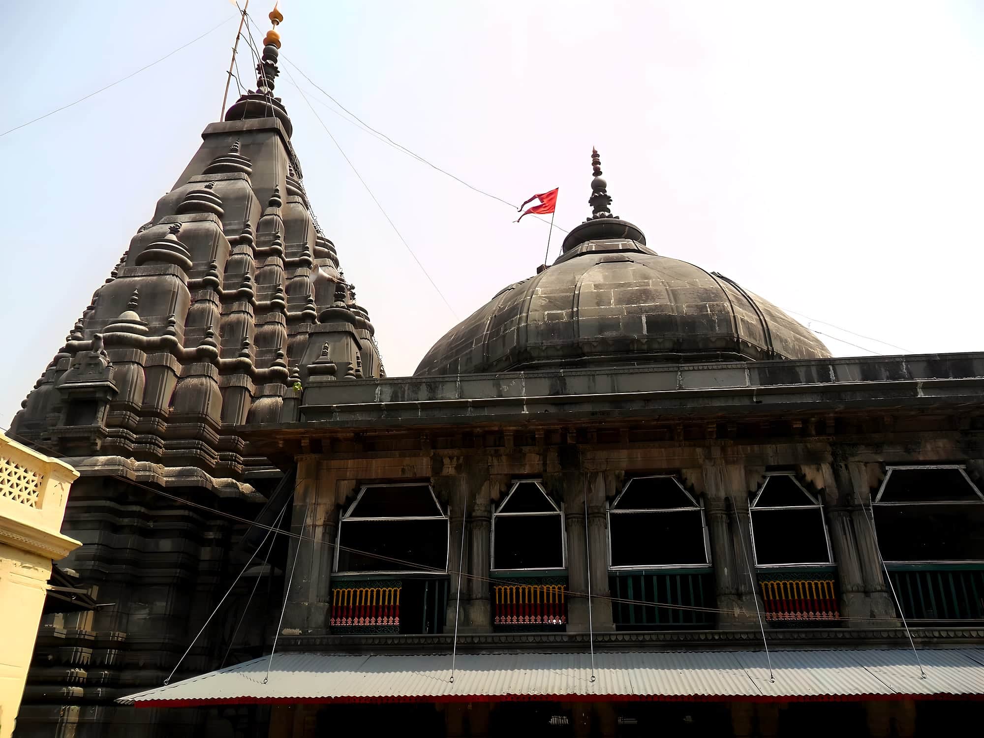
- The west-facing sanctum — Note the inscription on the north wall and the stepped tower..
- Surya Kund — The tank where Chhath arghya is offered; cleanest at dawn..
- Umga hill temple — 20 km — a granite Vishnu temple on a 300-step climb with Magadh spread below..
- Daud Khan Fort — Mughal fort by the Son at Daudnagar, 35 km..
Almost every Sun temple in India faces east. Deo's faces west — local tradition says Vishwakarma built it in a night and turned it round to settle a dispute about its origins. The shrine is a pyramidal Nagara tower of dressed stone, with a sanctum of Surya, and an inscription on its wall dates it to the 8th century under the King Aila of the Umga line. The Umga temple on its granite hill is 20 km away and clearly the same builders.
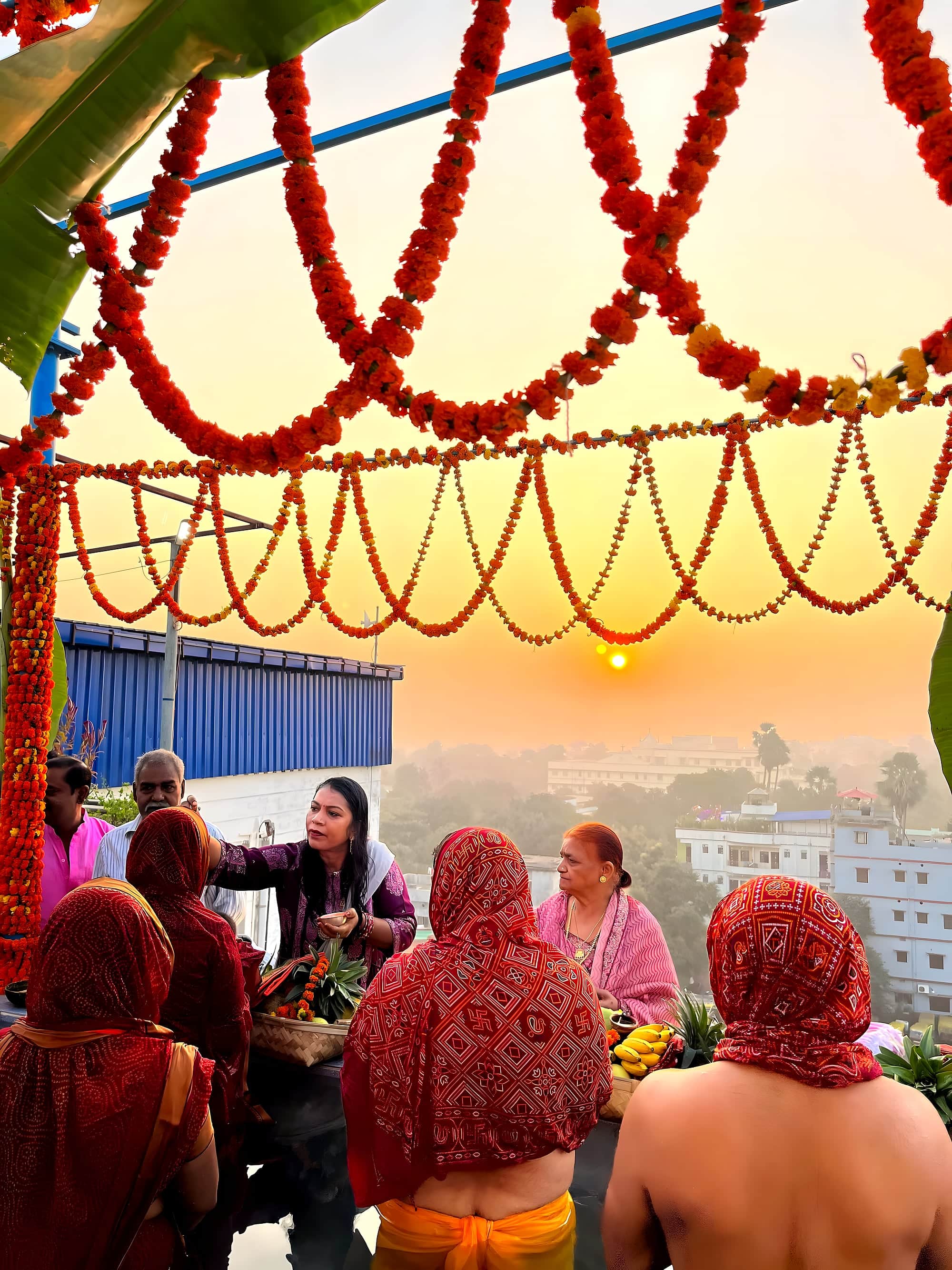
Deo belongs to Chhath. For the four days of Kartik Chhath (and again in Chaitra) lakhs of vratis stand in the Surya Kund tank at dawn and dusk; the town's streets fill with sugarcane, thekua and music, and the state runs special buses from Aurangabad and Gaya. It is the most intense version of the festival you can see outside Patna's ghats, and a good deal more intimate.
The rest of the year, come for the temple's carving, the tank, and a loop that takes in Umga, Daud Khan's fort at Daudnagar on the Son and the Sufi shrine at Amjhar Sharif.
Chapter 01
What to see
- 01
The west-facing sanctum
Note the inscription on the north wall and the stepped tower.
- 02
Surya Kund
The tank where Chhath arghya is offered; cleanest at dawn.
- 03
Umga hill temple
20 km — a granite Vishnu temple on a 300-step climb with Magadh spread below.
- 04
Daud Khan Fort
Mughal fort by the Son at Daudnagar, 35 km.
Practical
Getting there
Fly
Gaya (GAY) 75 km; Patna (PAT) 150 km.
Train
Anugrah Narayan Road (Aurangabad) 25 km, on the Grand Chord; Gaya Junction 70 km.
Road
10 km south of Aurangabad town, which sits on NH-19 (GT Road) between Sasaram and Dobhi.
On the map · Deo Sun Temple is at 24.6566°N, 84.4352°E in Aurangabad district, about 166 km (4 h) by road from Patna.
Before you go · Best time to visit · Safety, dress code & money · What to eat nearby
Practical
Distances from Deo Sun Temple
Road distance and realistic driving time on Bihar roads — plan around these, not the straight line on a map.
From the gateway cities
| Gaya → Deo Sun Temple | 77 km | 1½ h |
| Patna → Deo Sun Temple | 166 km | 4 h |
| Muzaffarpur → Deo Sun Temple | 244 km | 6 h |
| Darbhanga → Deo Sun Temple | 288 km | 7 h |
| Bhagalpur → Deo Sun Temple | 345 km | 8½ h |
To nearby places
| Deo Sun Temple → Tutla Bhawani | 52 km | 1 h |
| Deo Sun Temple → Dhua Kund & Manjhar Kund | 61 km | 1½ h |
| Deo Sun Temple → Rohtasgarh Fort | 68 km | 1½ h |
| Deo Sun Temple → Sasaram | 70 km | 1½ h |
| Deo Sun Temple → Bodh Gaya | 73 km | 1½ h |
| Deo Sun Temple → Gaya | 77 km | 1½ h |
| Deo Sun Temple → Barabar Caves | 97 km | 2 h |
| Deo Sun Temple → Shergarh Fort | 99 km | 2 h |
| Deo Sun Temple → Jagdishpur & Arrah | 117 km | 2½ h |
| Deo Sun Temple → Mundeshwari Temple | 126 km | 3 h |
| Deo Sun Temple → Telhar Kund & Karkatgarh | 127 km | 3 h |
| Deo Sun Temple → Bakhtiyar Khan's Tomb, Chainpur | 133 km | 3 h |
Estimates: road ≈ 1.3 × straight-line, ~40 km/h average. All Bihar distances →